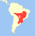
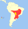
File:Distribuição cervo do pantanal atual.png
外觀

預覽大小:572 × 599 像素。 其他解析度:229 × 240 像素 | 458 × 480 像素 | 733 × 768 像素 | 977 × 1,024 像素 | 1,314 × 1,377 像素。
原始檔案 (1,314 × 1,377 像素,檔案大小:148 KB,MIME 類型:image/png)
檔案歷史
點選日期/時間以檢視該時間的檔案版本。
| 日期/時間 | 縮圖 | 尺寸 | 用戶 | 備註 | |
|---|---|---|---|---|---|
| 目前 | 2014年2月11日 (二) 16:42 |  | 1,314 × 1,377(148 KB) | Miguelrangeljr | Adjustments. Add some places where Marsh deer occurs missed in previous version. |
| 2013年6月18日 (二) 15:23 |  | 1,314 × 1,377(150 KB) | Miguelrangeljr | Change in limits and colors. | |
| 2012年4月1日 (日) 03:17 |  | 2,000 × 2,095(327 KB) | Miguelrangeljr | {{Information |Description ={{en|1=Geographic Distribution of Marsh Deer}} {{pt|1=Distribuição geográfica do cervo-do-pantanal}} |Source =Put together by User:Mysid using Geo::ShapeFile. Base map derived from File:Worldmap location NED 50... |
檔案用途
下列頁面有用到此檔案:
全域檔案使用狀況
以下其他 wiki 使用了這個檔案:
- ar.wikipedia.org 的使用狀況
- arz.wikipedia.org 的使用狀況
- avk.wikipedia.org 的使用狀況
- bg.wikipedia.org 的使用狀況
- ca.wikipedia.org 的使用狀況
- ceb.wikipedia.org 的使用狀況
- cs.wikipedia.org 的使用狀況
- en.wikipedia.org 的使用狀況
- es.wikipedia.org 的使用狀況
- eu.wikipedia.org 的使用狀況
- fa.wikipedia.org 的使用狀況
- fr.wikipedia.org 的使用狀況
- ga.wikipedia.org 的使用狀況
- gl.wikipedia.org 的使用狀況
- hu.wikipedia.org 的使用狀況
- id.wikipedia.org 的使用狀況
- ka.wikipedia.org 的使用狀況
- ko.wikipedia.org 的使用狀況
- ms.wikipedia.org 的使用狀況
- nv.wikipedia.org 的使用狀況
- pl.wikipedia.org 的使用狀況
- pt.wikipedia.org 的使用狀況
- sr.wikipedia.org 的使用狀況
- sv.wikipedia.org 的使用狀況
- vi.wikipedia.org 的使用狀況
- www.wikidata.org 的使用狀況


