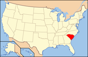
File:Map of USA SC.svg
外觀

此 SVG 檔案的 PNG 預覽的大小:286 × 186 像素。 其他解析度:320 × 208 像素 | 640 × 416 像素 | 1,024 × 666 像素 | 1,280 × 832 像素 | 2,560 × 1,665 像素。
原始檔案 (SVG 檔案,表面大小:286 × 186 像素,檔案大小:167 KB)
檔案歷史
點選日期/時間以檢視該時間的檔案版本。
| 日期/時間 | 縮圖 | 尺寸 | 用戶 | 備註 | |
|---|---|---|---|---|---|
| 目前 | 2006年6月9日 (五) 10:31 |  | 286 × 186(167 KB) | Huebi~commonswiki | {{Information| |Description=Map of USA with South Carolina highlighted |other_versions=image:Map of USA with state names.svg }} Category:Maps of the United States Category:Maps of South Carolina Category:SVG maps {{GFDL-en}}{{cc-by-2.0} |
檔案用途
下列9個頁面有用到此檔案:
全域檔案使用狀況
以下其他 wiki 使用了這個檔案:
- af.wikipedia.org 的使用狀況
- ang.wikipedia.org 的使用狀況
- an.wikipedia.org 的使用狀況
- ar.wikipedia.org 的使用狀況
- ay.wikipedia.org 的使用狀況
- az.wiktionary.org 的使用狀況
- bat-smg.wikipedia.org 的使用狀況
- bi.wikipedia.org 的使用狀況
- bo.wikipedia.org 的使用狀況
- bpy.wikipedia.org 的使用狀況
- bxr.wikipedia.org 的使用狀況
- ca.wikipedia.org 的使用狀況
- cs.wikipedia.org 的使用狀況
- cv.wikipedia.org 的使用狀況
- da.wikipedia.org 的使用狀況
- de.wikipedia.org 的使用狀況
- Benutzer:Wolfgang1018/Wikipedia-Quiz
- Kategorie:South Carolina
- Vorwahlergebnisse der Präsidentschaftswahl in den Vereinigten Staaten 2008
- Flaggen und Siegel der US-Bundesstaaten
- Vorwahlergebnisse der Präsidentschaftswahl in den Vereinigten Staaten 2016
- Vorwahlergebnisse der Präsidentschaftswahl in den Vereinigten Staaten 2020
- Vorwahlergebnisse der Präsidentschaftswahl in den Vereinigten Staaten 2024
- Benutzer:Sarkana/Vorwahlergebnisse 2024
- de.wiktionary.org 的使用狀況
- el.wikipedia.org 的使用狀況
- en.wikipedia.org 的使用狀況
- H. L. Hunley
- Fort Sumter
- USS Yorktown (CV-10)
- List of state and territory name etymologies of the United States
- Brookgreen Gardens
- Marine Corps Recruit Depot Parris Island
- USS Clamagore
- Category:South Carolina
- South Carolina State Museum
- Wofford College
- Daufuskie Island
- Fort Moultrie
- Hunting Island Lighthouse
檢視此檔案的更多全域使用狀況。


