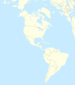
File:Americas laea location map with borders.svg
外观

此SVG文件的PNG预览的大小:531 × 600像素。 其他分辨率:212 × 240像素 | 425 × 480像素 | 680 × 768像素 | 906 × 1,024像素 | 1,812 × 2,048像素 | 2,655 × 3,000像素。
原始文件 (SVG文件,尺寸为2,655 × 3,000像素,文件大小:1.6 MB)
文件历史
点击某个日期/时间查看对应时刻的文件。
| 日期/时间 | 缩略图 | 大小 | 用户 | 备注 | |
|---|---|---|---|---|---|
| 当前 | 2012年7月14日 (六) 14:09 |  | 2,655 × 3,000(1.6 MB) | TUBS | {{Information |Description={{en|1= Location map of the Americas. * Projection: Lambert azimuthal equal-area projection. * Area of interest: :* N: X.X° N :* S: -X.X° S :* W: -X.X° E :* E: -X.X° E * Projection center: :* NS: 20.0° N :* WE: 90° W * ... |
文件用途
以下5个页面使用本文件:
全域文件用途
以下其他wiki使用此文件:
- ar.wikipedia.org上的用途
- ast.wikipedia.org上的用途
- ca.wikipedia.org上的用途
- ceb.wikipedia.org上的用途
- de.wikipedia.org上的用途
- en.wikipedia.org上的用途
- Guatemala City
- Panama City
- Bogotá
- Whitby, Ontario
- 2004 Summer Olympics torch relay
- Battle of Boyacá
- Battle of Angamos
- Battle of Cajamarca
- Johan Adolf Pengel International Airport
- Battle of Las Salinas
- Talk:International Football Association Board
- Battle of Cusco
- Wet 'n Wild (brand)
- Battle of Topáter
- Battle of Pisagua
- Battle of Suipacha
- Battle of Viluma
- Battle of Vilcapugio
- Battle of Ayohuma
- Battle of Ingavi
- Battle of Cotagaita
- Battle of Yavi
- Battle of Salta
- Battle of Tucumán
- Battle of Pequereque
- Action of Tambo Nuevo
- Parapan American Games
- Arctotherium
- Campo Vía pocket
- Battle of Gondra
- Battle of Kilometer 7
- Battle of la Tablada de Tolomosa
- Module:Location map/data/America/doc
- Second Battle of Nanawa
- First Battle of Nanawa
- Battle of Boquerón (1932)
- Battle of Cañada Strongest
- 2012 Web.com Tour
- Terrestrial analogue site
- 2013 Web.com Tour
- User:Spshu/Sandbox4
查看此文件的更多全域用途。


